Clouds are here and we will see some minor rains move through the state today. This cool front will bring .1”-.5” rains to roughly 80% of the state. The best rains will be midday through afternoon and should be winding down by sunset. Breezy conditions are in tomorrow behind this little system, but we may not be able to see full sunshine. We have concern that clouds hold thanks to strong NW flow into the state. But, we at least get by with no new precipitation tomorrow.
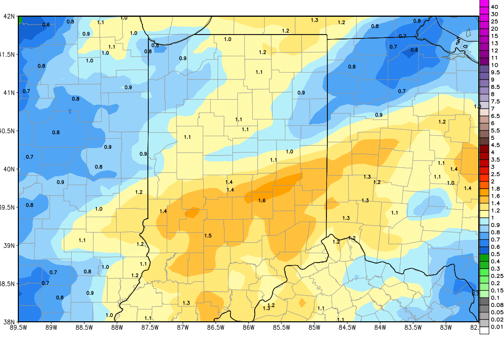
 A stronger front is on the way for the weekend and clouds build Friday morning. Scattered, light precipitation breaks out by midday over parts of Indiana, and will focus mostly on the northern half of the state. Heavier rains move in overnight through the first half of Saturday. The threat of thunderstorms is smaller again, but we do think we can see heavier rains out of this event. Right now, we are leaving rain totals at .25”-.75” over 100% of the state, but are leaving the door open to some 1” totals on a localized basis. The map above shows combined rains today through the weekend.
Drier for Sunday and Monday, as we have been looking for over the past few forecasts. However, we do have some changes for next week. The next system we had been projecting for next Tuesday has dissipated. In fact, moisture looks to get locked up to the south over the Lower Mississippi valley at midweek. So, we stay dry for Tuesday right on through the balance of the week. But, it comes at a cost. Cold air looks more impressive now for Thanksgiving Day and on through the balance of the holiday weekend. A strong surface high comes out of Canada and parks right on top of the eastern US. This keeps moisture locked up well to the south, but puts temps below normal right on through the holiday weekend.
In the extended period, we may see some of that moisture from the Deep South move into the OH valley late next Sunday as the cold core high starts to move off to the north and east. That looks to allow a more active pattern to gain ground again, with rains developing around Thursday the 30th. The rains will be under a half an inch and will favor the southern part of the state if things play out as we see them right now.
Overall, the biggest headlines this morning are the potential for heavy rain still this weekend, drier weather next week, and a cold push for the holiday weekend.