Minor changes this morning to our forecast for southern Indiana. Moisture pushed a little farther north overnight, and with cold air blasting in this morning, we are seeing precipitation end as some snow. There will be minor accumulations of wet snow south of I-70, and in some spots we can see up to a coating to an inch or two. This will not hang around long term, but the snow does not completely push off to the east until midday or early afternoon. Areas to the north of I-70 see only clouds and much colder air.
Strong north winds remain in our forecast for tomorrow. These winds will trigger some wrap around snows in Ohio, but we still don’t think anything is able to gain traction back here. We will keep tomorrow, Thursday and Friday dry over the state. Temps stay cold tomorrow and Thursday, but start to moderate just a bit on Friday as south winds arrive ahead of our next front.
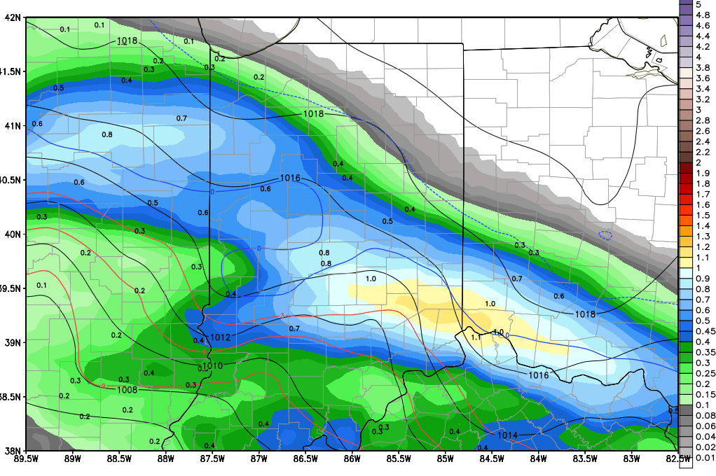 That system moves in for Saturday. Rain totals will easily be .25”-1” over the entire state, unchanged from yesterday’s thoughts. The upper end of the range will from potential thunderstorm action later Saturday afternoon and evening, mostly from central Indiana back into northeast IL. All rains still look to be done by Sunday morning but as temperatures fall behind the front, we are opening the possibility that the precipitation ends as wet snow over a large part of the state. We can see minor accumulations of a coating to an inch once again. The map above is a snapshot of potential action Sunday evening
Dry for Sunday afternoon and Monday of next week. But, then the pattern becomes a little more active. WE have showers that move through overnight Monday night through Tuesday bringing .05”-.5” to about 70% of the state. Then we take a minor break with dry weather Tuesday night and Wednesday, followed by another batch of scattered showers for Thursday, adding another .25” over 60% of the state.
Moderate to heavy rains arrive for Easter weekend on the 31st and 1st. We are raising rain totals to .5”- 2” over 100% of the state. This will be a very moisture laden system. But then we go dry for the 2nd through the 5th for the remainder of the extended forecast window.
