Moisture exits the state today, and we see better weather developing ahead of us. Light rain/drizzle/wet snowflakes will be around this morning, mostly in NE and east central Indiana. All of this action is out of the state to the east by mid to late morning. From there, clouds break up, and we feel most of the state will be seeing sunshine by sunset.
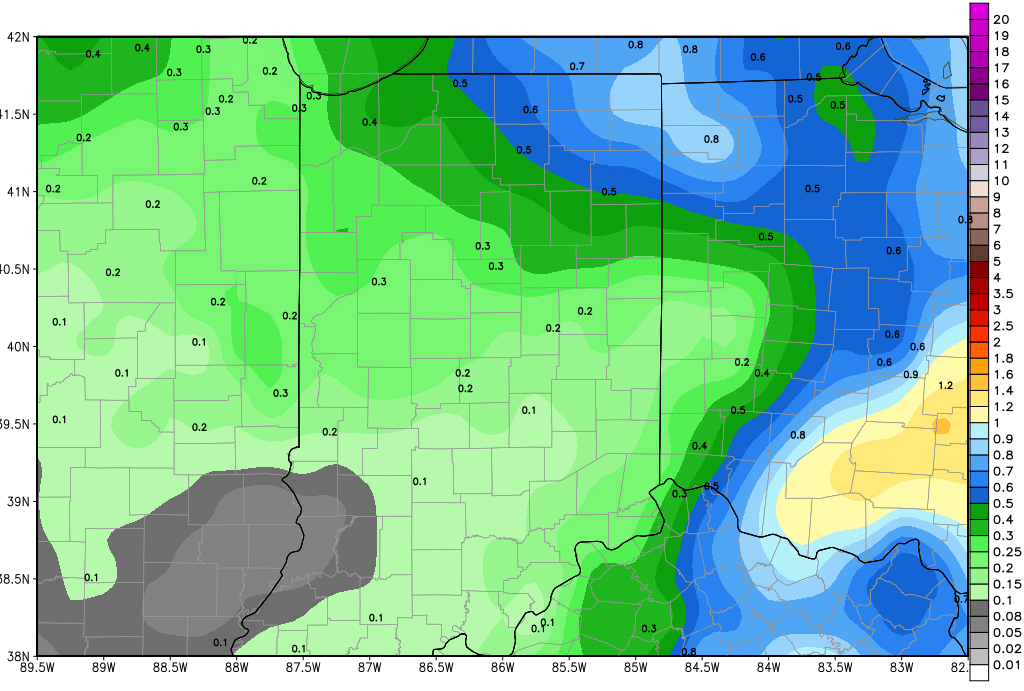
Dry weather continues through all of tomorrow, the weekend, Monday and Tuesday of next week. Models threw a new wrinkle in late yesterday, bringing a stronger system out of the northern plains, across the upper Midwest and into Indiana next Wednesday afternoon. We do not like to change our forecasts based on one model’s look at things and after just a model run here or there. But, we are seeing some confirmation this morning from other looks, and we are going to have to insert some action for next Wednesday afternoon, Wednesday night and even into Thursday. Rains will likely be from .25”-.75” over about 80% of the state. The set up looks to provide a few holes in coverage, but still, this moisture will come at a time sure to disrupt field work. The map below shows cumulative rain total by Thursday morning.
We go back to drier weather for the balance of the week, from Thursday afternoon through Friday. A minor batch of clouds move over the state overnight Friday night into Saturday, and that could trigger a shower or two, but precipitation will be limited to 25% coverage and totals of a tenth or less…so not a big deal. Better rain potential develops later Saturday afternoon, the 28th into the 29th, where we can see up to .5” over about 50% of the state. That system looks to focus a little more on Ohio, honestly, than it did earlier in the week.
A strong front sets up over the Corn Belt in the May 2nd to May 4th time period. This front does not have a lot of movement with it, and may stall over the region until a stronger low is able to move up it. That will allow for scattered showers through the period. Right now, the best rains stay west of us, but this is a highly unsettled pattern, so we could end up having to raise rain totals here. Suffice to say, the start of May has the potential to be wet, and it would not surprise us to see moisture hold into the 5th.
Temperatures are still chilly today, but moderate some over the weekend. We should see temps getting closer to normal, but they will not exceed normal. We still have a bias of at least 5-7 degrees below normal on average now through the end of the month, which is better than we had been…we feel our worst cold is behind us.
