Dry weather is back over the state today. Clouds give way to more sunshine as the day progresses, and we should see moderate temps. The dry weather holds for tomorrow as well.
Our front for Friday continues to look very unimpressive. We won’t completely rule out moisture over the northern half of the state from Friday afternoon through midnight. Moisture totals will be anywhere from a few hundredths to .15” with 50% coverage. South of I-70, we feel confident now saying we stay dry. That will work out well, as those are the areas that saw the biggest rains over the past two days. The upper end of the aforementioned rain range will be near the Michigan line.
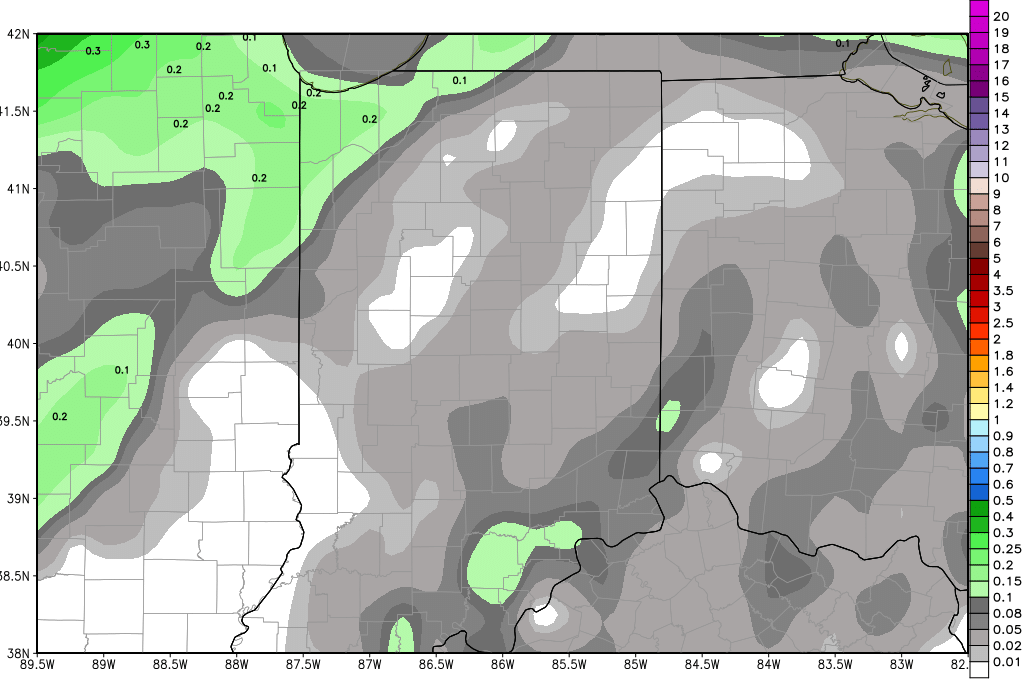
Dry weather then settles in for this weekend and now looks like it could continue through most of next week. Our strong front that we expect to sweep across the Corn Belt comes into western areas like IA and MO on time on Tuesday, but it runs into a significant blockage and is slowed dramatically. WE may not see rain develop here until late in the week next week – maybe Friday. That will allow for a nice, usable planting window, if things continue to work toward that solution. The map above is a look at total rain potential from now through next Thursday.
We keep a chance of rain in for late next week, the 4th into the 5th, and will keep rain totals from the front at .25”-1”. In the extended period, a weak front brings up to .25” around the 7th, and another system can pop up near the 12th. But, the pattern is showing some good chances for activity between strong fronts going forward.
Temps will warm to normal and slightly above normal levels next week in early May as the dry weather unfolds.
