Rains are winding down this morning, and we will take a little break before our next system. Colder air will funnel into the state from the NW through the day today, and we will see temps pull back from yesterday’s exceptionally mild push. However, we don’t get exceptionally cold, and the cold air does not stay. Rains through the first half of the day today will be mostly limited to southern Indiana, and by midafternoon we will be rain free statewide.
Dry to start the day tomorrow, but our next minor wave is coming a little quicker. This wave will act as a minor warm front as winds return to the southwest. We can expect scattered light precipitation from late tomorrow afternoon and through the overnight. This overrunning will be predominantly rain shower action, but over the northern third of the state we can see some sloppy wet snowflakes mix in. Moisture totals are unimpressive, at a few hundredths to .1” maximum. Still, it makes for a damp interlude in the middle of the weekend.
Sunday now looks mostly dry and warmer, since we are speeding up the aforementioned wave. Southwest winds will pick up through the day, and we should see well above normal temps. Clouds will build.
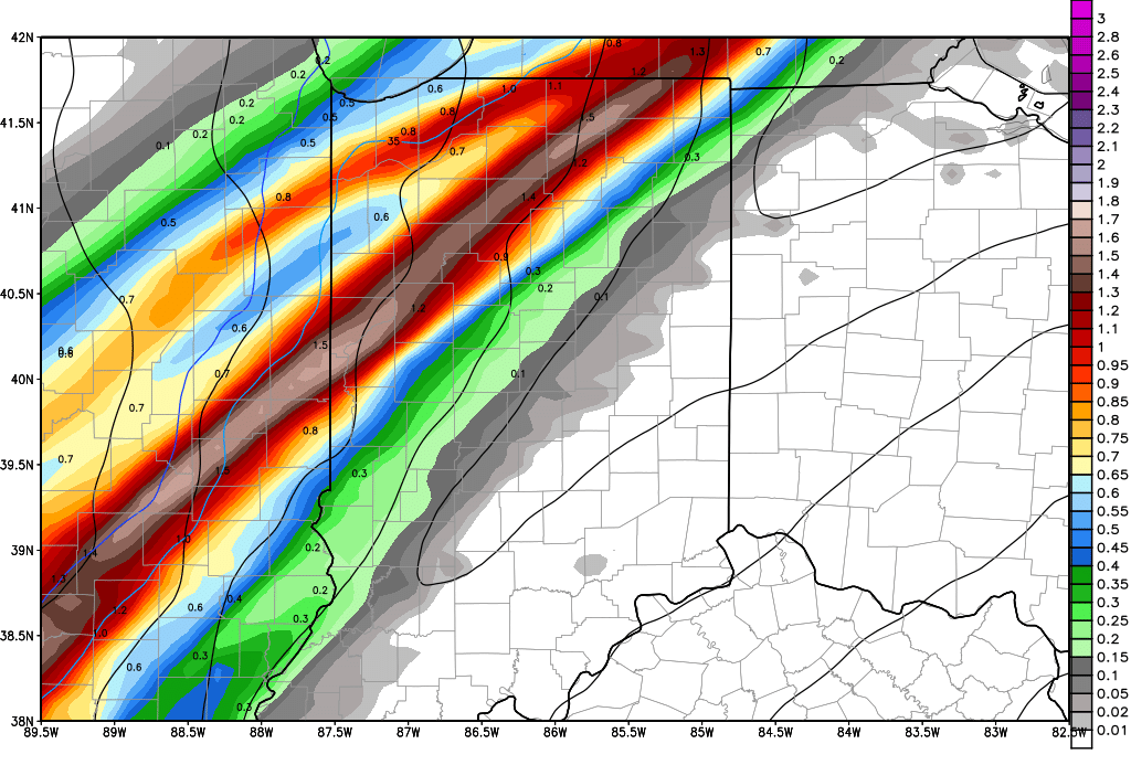
The start of next week still looks very wet. Rains start overnight Sunday night into Monday. We see 3 distinct waves coming through Monday through midweek. On Monday we can have .25”-1” rains with 100% coverage, which is a bump up from our previous forecasts. Tuesday, we can see a few hundredths to a third of an inch with 50% coverage, skewed north. This is a decrease from our previous forecasts. And for Wednesday, we see 1-2 inch rains with 90% coverage. There can be some thunderstorm action in there for Wednesday. Most of the Wednesday action happens early, from Midnight through noon. Combined rain totals for the first half of the week can be at least 1-3 inches, over the entire state. The map below shows a snapshot of next Wednesday morning, shortly after midnight, when the heaviest rains may be trying to develop.
Drier and cooler behind that action. We dry down Wednesday night, and then stay dry Thursday into early Friday. A southern wave moves across central and southern Indiana Friday midday and afternoon, bringing .05”-.4” rains with 80% coverage south of I-70. This is a new addition to our forecast. Then we are dry for Saturday, but have a massive system looking to arrive overnight Saturday night through Sunday.
The second half of the weekend will feature moderate to heavy rains from that system. WE expect half to 1.5” rains over 90% of the state. Temps remain mild as the precipitation falls, meaning we are looking at all rain. However, cold air races in on the backside of the circulation, so there is potential to have to talk about some snow next Sunday night into Monday.
The extended period remains keen on a system for the 28th into the 1st. This system sweeps through the entire eastern Corn Belt, and may bring half to 1” rains. The heavier rains look to stay a little farther south, and that is why we have reduced our top end on this system this morning.
Temperatures look to be mostly normal to above normal through the next 10 days. The last few days of February and the start of March look like they could turn colder…but we have plenty of time to see that set up change.
