Status quo this morning as the next several days will all look very similar. Our drier pattern continues today, and temps will be above normal once again. Full sunshine is in our forecast today through early next week. Temperatures may push 90 over parts of the state, upper 80s in the rest!
Our next front is still headed toward the area for midweek next week. The front still has its best moisture out west, where .75” can fall in IA, MN, WI and northern MO, mostly on Tuesday. But, by the time that front gets here on Wednesday, it looks pretty much dead and rained out. We will see that front pass, and there will be some clouds and a wind shift, but precipitation will be limited to a few hundredth to a tenth. That’s all. The front will also move through quickly, being off to the east by late Wednesday afternoon. The western corn belt, here, we think a few hundredths to at most a quarter of an inch with 50% coverage next Wednesday might be the best we can do. This looks like a rather dry pattern emerging.
After that front passes, we are back to our dry outlook for the last part of the week, Thursday into at least the weekend. However, the big change will be temperatures, which are likely to retreat quickly to near normal levels and may even slide slightly below normal toward the weekend. In the extended period, the front in early October is in fact gone, and we may not see another significant rain chance until we get closer to week 3. We will address the further long term outlook in our first Harvest Forecast of the season, due out this weekend here at Hoosier Ag Today!
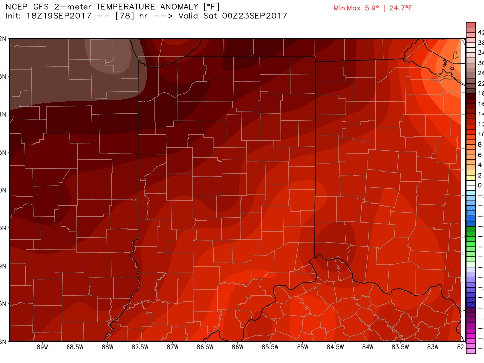 We move into a drier pattern today as warmer air surges northward. We will see some on and off clouds over the state today, but precipitation is not going to be a significant part of the forecast at all over the next week. Temps to finish this week will be well above normal, staying that way into the weekend and early next week. The map shows temps in relation to normal for this Friday (high temps). Notice we are very warm for this time of year…anywhere from 8 to 20 degrees above normal over the eastern corn belt!
 Scattered showers move across the state today as a second wave of moisture moves through right on through this afternoon and evening. We could see some better moisture today in spots, but will still be looking at about 60-70% coverage across the state. We are putting rain totals in at .1” to 1”. The best rains this morning will be over northern and western areas, and action will slowly drift east and south as the day progresses. The map above shows a cumulative rains by early tomorrow morning.
 Dry today, tomorrow and most of Sunday. Our next front arrives Sunday night and moves over the state through Monday. Rain totals look to be from a few hundredths to half an inch with coverage at 60% of the state. The best chance to get into the upper part of the rain range now is moisture lingering longer through the day Monday. But, that does not happen over large parts of the state. Everything is gone by overnight Monday night. The map above shows cumulative rain potential through early Tuesday morning.