Author: weatherstud

Indiana Weather Outlook 4-20-18

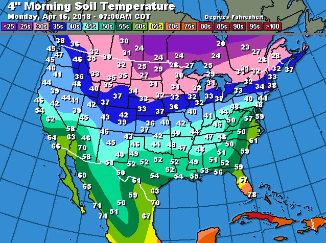
Dry weather continues through Monday. We are putting precipitation into our forecast this morning as our next wave seems to be picking up just a little speed. Still, with yesterday turning out dry basically from just after sunrise, we still will be able to put 5 complete dry days on the books by the time Monday is done. Temps will be climbing slightly through the dry stretch, but will not really exceed normal. Most of this is due to the fact that we really do not see any significant south wind over the weekend, and see more easterly flow, which does not promote strong warming. The set up will produce some drying, but time will tell if it is enough. The same can be said about a rise in soil temperatures.

gfs_tprecip_indy_26.png
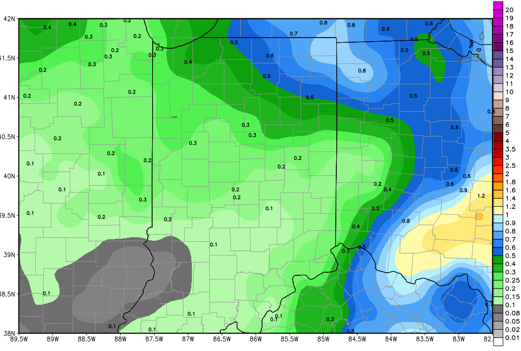
Rains start to push up into southern Indiana next Tuesday mid-morning to mid-afternoon. From there, we see a slow spread north, to eventually bring scattered showers to 80% of the state for the balance of Tuesday and Wednesday. Moisture totals have a wide range, from .1” or less up north to a combined total of .8” in southern Indiana. This will interrupt field work in many locations, although we can make the argument that we might be able to skirt by and keep at it north of US 30. The map above shows rain totals through Wednesday evening.

Behind that moisture, we dry back down for 3, and in some cases 3 and a half days, for Thursday, Friday, Saturday and perhaps the first part of Sunday (29th). Then we kick off a very active pattern for the extended 11-16 day forecast window. Rains of .5”-1” move across the state with 90% coverage for the 29th and 30th. We take a brief break for Tuesday May 1st and also the 2nd, but we really still have plenty of clouds possible and a damp overall feel. Then heavy rains are back for the 3rd through the 5th, with half to 1.5” possible, and there is an outside chance for some isolated 2” totals. Coverage of those early may rains will be 100% of the state.

So, short term, this window we have through Monday is about the best we can do. Conditions will be breezy through the weekend, so spraying may be limited to early morning or early evening hours, if at all. This kind of forecast is one we need, but we need it for a bit longer than 5 days total.


Indiana Weather Outlook 4-19-18

Moisture exits the state today, and we see better weather developing ahead of us. Light rain/drizzle/wet snowflakes will be around this morning, mostly in NE and east central Indiana. All of this action is out of the state to the east by mid to late morning. From there, clouds break up, and we feel most of the state will be seeing sunshine by sunset.

Dry weather continues through all of tomorrow, the weekend, Monday and Tuesday of next week. Models threw a new wrinkle in late yesterday, bringing a stronger system out of the northern plains, across the upper Midwest and into Indiana next Wednesday afternoon. We do not like to change our forecasts based on one model’s look at things and after just a model run here or there. But, we are seeing some confirmation this morning from other looks, and we are going to have to insert some action for next Wednesday afternoon, Wednesday night and even into Thursday. Rains will likely be from .25”-.75” over about 80% of the state. The set up looks to provide a few holes in coverage, but still, this moisture will come at a time sure to disrupt field work. The map below shows cumulative rain total by Thursday morning.

gfs_precip_120hr_indy_33.png

We go back to drier weather for the balance of the week, from Thursday afternoon through Friday. A minor batch of clouds move over the state overnight Friday night into Saturday, and that could trigger a shower or two, but precipitation will be limited to 25% coverage and totals of a tenth or less…so not a big deal. Better rain potential develops later Saturday afternoon, the 28th into the 29th, where we can see up to .5” over about 50% of the state. That system looks to focus a little more on Ohio, honestly, than it did earlier in the week.

A strong front sets up over the Corn Belt in the May 2nd to May 4th time period. This front does not have a lot of movement with it, and may stall over the region until a stronger low is able to move up it. That will allow for scattered showers through the period. Right now, the best rains stay west of us, but this is a highly unsettled pattern, so we could end up having to raise rain totals here. Suffice to say, the start of May has the potential to be wet, and it would not surprise us to see moisture hold into the 5th.

Temperatures are still chilly today, but moderate some over the weekend. We should see temps getting closer to normal, but they will not exceed normal. We still have a bias of at least 5-7 degrees below normal on average now through the end of the month, which is better than we had been…we feel our worst cold is behind us.


Indiana Weather Outlook 4-18-18

Increasing clouds today as low pressure moves into east central IL this morning. This low will bring moisture back into the state shortly after midday, and we will see on and off showers tracking mostly across the northern part of the state through the late afternoon, evening, and overnight and into tomorrow morning. Moisture does not look that impressive, still under a quarter of an inch for the most part, although a few locations may push closer to a third. Liquid precipitation it expected through the daylight hours, but temps fall tonight, meaning after midnight we may be able to see some mixing or change over to light wet snow. We do not expect any problems, and the wet snow will be limited in coverage. Precipitation in generally will mostly be over the northern third of the state, although we will allow for some afternoon scattered showers down to I-70. South of 70 we see nothing.


We dry down and see clouds break up tomorrow afternoon and se should see sunshine in full force ahead of sunset. We then keep a dry pattern in our forecast dry for Friday through the weekend and for most of next week. The chances of precipitation for Tuesday continue to fall off, and at this point, we think that we end up with nothing but clouds and a few spits or sprinkles over southern Indiana Tuesday afternoon, and nothing anywhere else. The dry weather then continues for Wednesday, Thursday and Friday.


There is still a good chance of moisture with a strong system around the 28th into the 29th. Moisture totals are not as impressive this morning, but we still are leaving the door open to some rains from .25”-1” over 70% of the state. Then we have an unsettled finish to the 11-16 day forecast window. Models are unsure how to handle moisture, but we do expected at least one more strong front between the 2nd and the 4th. The front likely has some strong to severe weather potential and can bring rains up to 1”. Timing is the main uncertain part to precipitation in early May.


Temperatures likely do not get quite as cold as what we saw Monday again. However, we are still projecting a mostly below normal temperature profile through the end of the month. A couple of moderating days will be in there, but generally, we stay cool. Keep in mind, normal temps are rising, rather rapidly this month, as we pointed out before…but still, we do not see any significant above normal warming coming for at least several more weeks.

Indiana Weather Outlook 4-17-18

Continued cold today. Northwest winds dominate the landscape, but we at least see a little less available moisture. Clouds will fight for space with sunshine, and we can’t rule out lingering wet snowflakes, mostly over the northern half to third of the state. However, temperatures today should be a couple degrees warmer than yesterday. Sunshine has a better chance at winning the war with clouds over southern Indiana.

Wednesday will be mostly dry statewide with a mix of clouds and sun. Clouds will be thickening up Wednesday afternoon as our next frontal complex draws close. South winds ahead of that system should take temps a little higher, closer to normal. This will, not be a significant warm up, though, and the moderation will be very short lived.

Moisture moves in tomorrow evening and then continues through Thursday. Available moisture is not all that impressive, but we draw our rain chances out over the entire period. We look for a few hundredths of an inch up to .25” with coverage at 60%. SW Indiana likely misses out along with areas near the Ohio River. All moisture is done by late Thursday afternoon.

We are keeping our forecast dry for the Friday, Saturday and Sunday time period and are also looking to add Monday to this. The system coming up from the southwest does not look as impressive for early next week. Temps stay cool through the weekend, and will start to moderate just a bit on Monday, as south flow starts to develop ahead of that SW circulation.

We our pushing that next system back into Tuesday, reducing its footprint and its rain potential this morning. In fact, there is a good chance that we escape the first part of the week with no precipitation in Indiana, short of a few scattered showers near the Ohio River. This system is waiting until it gets farther east into OH before it shoots north. Now, that means we still have to watch this event, as any slowing or strengthening could adjust that track back into our area. But, at the moment, it looks like we can catch a break and get through the period with little action, and we may actually be able to put together a significant string of dry days over a large part of the state, particularly up north. AT this time, temps look to stay cool, though, so we will not dry down quite as fast as we otherwise could, and soil temps will not move all that fast. But, it is an improvement over previous forecasts.

Strong Canadian high pressure slides into the region at midweek next week, meaning we see a reinforcing shot of cooler air spreading across the eastern Corn Belt. This high promotes dry weather. So, if we miss out on action next Tuesday, there is potential that we are dry from this Thursday right on through next Friday, the 27th. This will be watched very closely. Then, a cold front works in from the northwest for the 28th and moisture associated with that stalling front can hold through the 1st. As precipitation dissipates for the 2nd, we should see high pressure settle in over the Great Lakes for a couple of days, before another system lifts out of the central and southern plains around May 4th. While we have a few attempts by our atmosphere to moderate between now and months end. For the most part we average 5-15 degrees below normal for the rest of April on the whole. That means soil temperatures will be slower to move…although they will be moving upward. Below is a map of soil temperatures from yesterday. We have some work to do!

soil temps 4-16